Navigating Modern Surveying: An Insight into TerraWise’s Advanced Data
Collection Techniques
Surveying has evolved with the integration of cutting-edge technology. When your
construction team is equipped with the latest surveying tools, you can gather
valuable data to complete projects with precision, accuracy, and efficiency. Here’s a
look at the resources available to you via TerraWise Solutions and how you can use
them to support your construction projects.
Leica GS18 I
Leica GS18 I is a Global Navigation Satellite System (GNSS) Real-Time Kinematic
(RTK) rover with visual positioning. Thanks to the combination of GNSS, Inertial
Measurement Unit (IMU), and a camera, this device is designed to help you easily
and accurately measure points that previously could not be measured with a GNSS
rover. With the CG18, surveying professionals can capture images of the site and
measure hundreds of points from the images within minutes. The added flexibility
in the field allows you to maximize your crew’s productivity and increase your
profits.
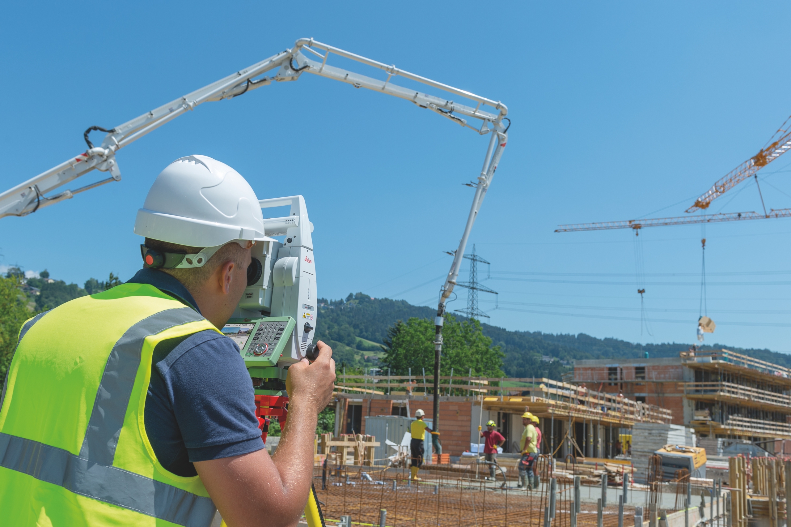
Leica TS16
The Leica TS16 is a self-learning total station that was created from 200 years of
research and development. It’s a reliable solution that offers minimal downtime and
the ability to find, follow, and re-lock to your target. The Leica TS16 delivers
accurate data when you need it, wherever you are. It uses topographic surveying to
provide data collection, control point measurements, computations, and
adjustments. The TS16 can also be used for stakeout and construction
measurements, including stakeout design data, building information modeling
(BIM), clearance checks, and as-built checks.
With the Leica TS16, you can quickly transfer data from the field to your office, and
vice versa. This tool helps reduce human error, eliminates the need for a measuring
tape, and ensures you get the correct height of the instruments you’ve measured.
Leica MS60
The Leica MS60 is the first self-learning multi station in the world. Featuring a
variety of measurement technologies, it continuously and automatically adapts to
any environment. The MS60 makes scanning easier by instantly creating point
clouds with overlaid measured points and 3D models in one view. The Leica MS60
turns complex data into realistic 3D models that are easy to view and work with.
Additionally, the new 5” screen makes visualizations clearer and easier to see. The
MS60 also includes the Dynamic Lock feature, which makes it faster to detect, lock,
and follow a target – erasing the need to stand around waiting for your device to
lock. This allows you to save time and complete projects faster while trusting the
accuracy of your data.
Find the Best Surveying Tools for Your Data Collection Needs
Using modern surveying technology is crucial for collecting important data that
makes the construction process more efficient and more accurate. To find the right
tools for your project, turn to TerraWise Solutions. We offer a variety of surveying
equipment, including the Leica tools mentioned here and so much more. We’ll get
to know your company and your needs, then help you determine the best solutions.
Contact us today to learn more.